Beobachtungsdaten und Synergistische Produkte
Aus der Kombination der vier Instrumente wird EarthCARE über 40 verschiedene Datenprodukte liefern. Der Download der Daten erfolgt über das ESA Datencenter genauso wie für die Beobachtungsdaten der einzelnen Instrumente.
Synergistische Beobachtungsdaten:
Auf Level 2 der EarthCARE Datenprozessierung stehen die synergistischen Daten, welche sich aus der Kombination von beiobachtungen von ATLIT, CPR, MSI und BBR ergeben.
Überblick über synergistische Datenprodukte
Die vier Instrumente auf EarthCARE liefern folgende Basismessungen, welche im Level-1b erhältlich sind:
- Atmospheric Lidar: Attenuated backscatter Signal aus drei Kanälen: Rayleigh Kanal, Co-polar Mie, Cross-polar Mie
- Cloud Profiling Radar: Radar Reflektivität und Doppler Profile
- Multispectral Imager: Top-of-the-atmosphere Strahlung aus vier solaren Kanäle, Top-of-the-atmosphere Strahlungstemperatur aus drei thermalen Kanälen
- Broadband Radiometer: Top-of-the-atmosphere langwellige und and totale Radianzen.
Level-2 Datenprodukte sind geophysikalische Produkte welche aus den Level-1b Daten und den Auxiliaren Daten, wie zum Beispiel meteorologische Daten vom ECMWF abgeleitet wurden. Diese Level-2 Datenprodukte enthalten:
- Vertikalprofiele von Eiswolken und Wassergehalt, effektive Partikel und Tröpfchengrößen, Wolkenober- und Unterkante, Multilayerwolken, Wolkenbedeckungsgrad und Überlapp.
- Vertikalprofiele von Aerosolextinktion, Grenzschichthöhe und Aerosoltyp.
- Synergistisch ermittelte 3D Wolken- und Aerosolscenen.
- Beobachtete top-of-the-atmosphere Breidbandradiometer- und Strahlungsgrößen (top-of-the-atmosphere und Bodenfluss, Vertikalprofiele der heizraten) Berechnungen von abgeleiteten Wolken und Aerosolfeldern.
Diese Datensetzte werden unter der Ausnutzung von synergistischen Messungen der einzelnen Instrumente erstellt, welches ein klarer Vorteil und eine Stärke des EarthCARE Satelliten darstellt.
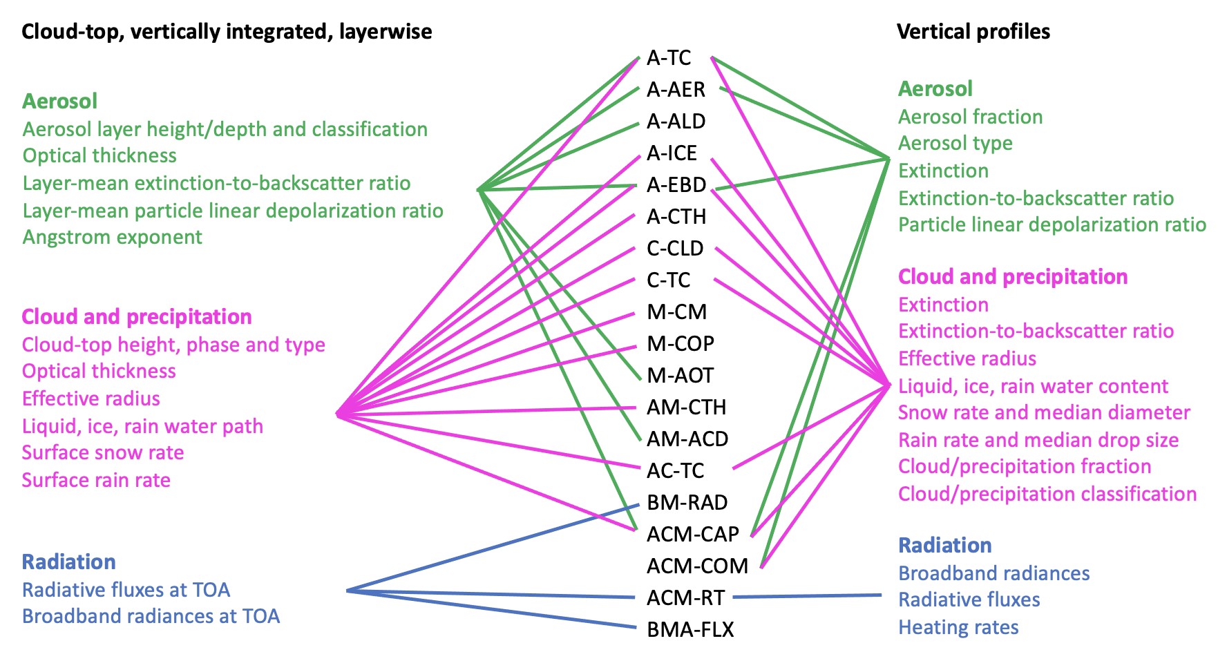
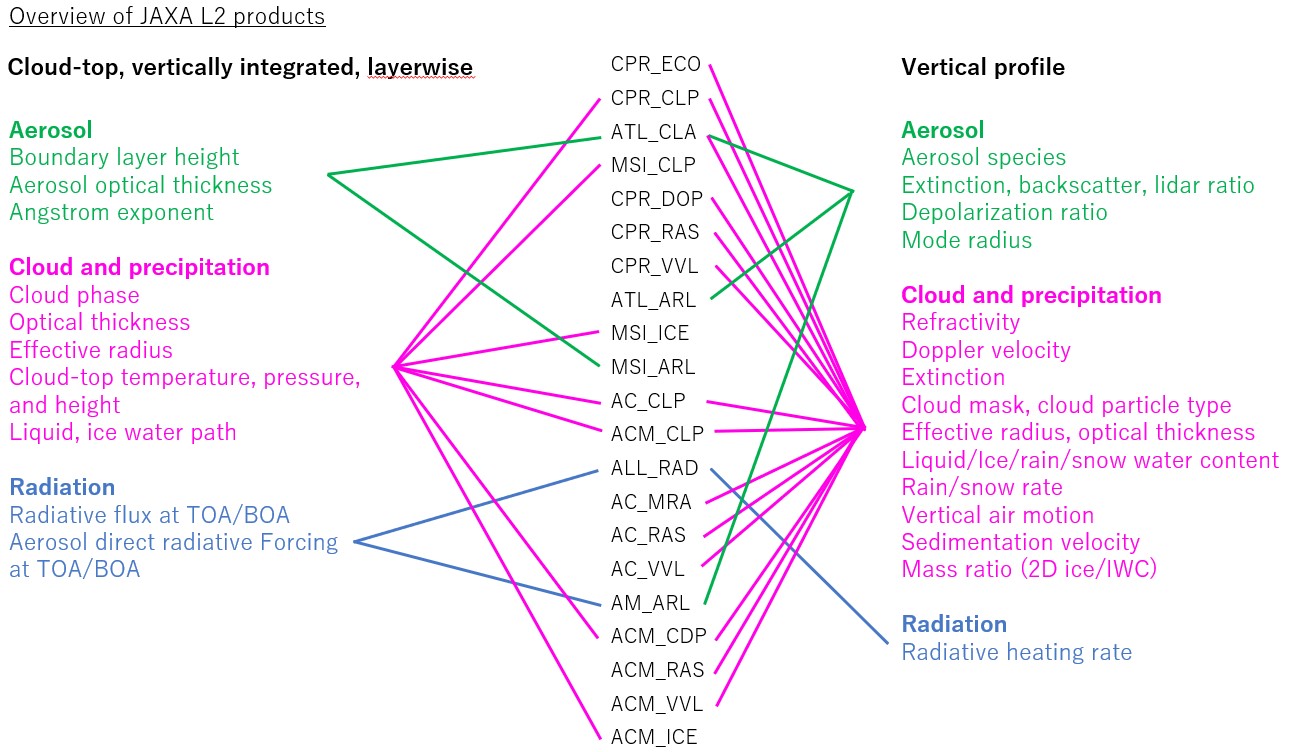
Die Level-2 Datenprodukte lassen sich in zwei Gruppen (a und b) unterteilen:
- Level-2a Datenprodukte sind geophysikalische Parameter, welche aus einzelnen EarthCARE Instrumenten abgeleitet wurden
- Level-2b Datenprodukte sind geophysikalische Parameter, welche aus synergistischen Messungen der EarthCARE Instrumente abgeleitet wurden. Dabei sind mindestens zwei oder mehr Instrumente enthalten.
Die nachfolgende Liste zeigt die Level-2a and Level-2b Datenprodukte welche gemeinsam mit ESA und JAXA entwickelt wurden. Eine genauere Beschreibung der einzelnen Daten findet sich im Datenportal der ESA.
